Well, it happened. I can’t take it anymore!
No, not flying or even training. I am tired of flying solely in my local area. I mean really, how fun is this:
“What are we going to do today?”, “Let’s go to the south practice area, and then shoot an approach or two.”
B-o-r-i-n-g.
I didn’t get my pilot’s certificate to stay in my local area. I want to explore the country. Discover a new place to grab a bite to eat and go somewhere that you couldn’t easily reach in your car and be home by lunch. And I don’t want to have to go through the hassles of a TSA strip search just to do it.
THAT’S why I got my certificate.
So, now that we have the problem identified what’s the solution? A cross country! This way I can see a new airport, and knock out several training lessons all at once.
Where are we going
On this trip we are doing a 3 airport run. I’ll be starting out of my home airport of KABQ, navigating and flying out to Roswell (KROW) to shoot an approach or two and then go to Alamagordo (KALM). We will most likely stop in Alamagordo for some grub and then back to home base.
This trip will add two new airports to my logbook as well as give me some much needed cross country hours. The grub stop hasn’t been finalized yet. Though it would be nice to say hi to any aliens we may encounter in Roswell.
Initial Planning
My basic steps to plan a trip are almost the same as planning a VFR trip. You can check out my previous blog post to see how similar these steps are.
My first step in planning this trip was to get foreflight out and set it up for an IFR trek. Here are the two things I change from how I normally have it set up:
- Select the IFR (low route) maps
- Update altitude in the flight plan (FPL) tab
Next, I typed the very basic route into the search bar in the top right corner of the screen. KABQ KROW KALM KABQ. This gives me a general look at what the flight should look like.
A few things to note right off the bat is where the initial flight line goes. Is it along a published route? Can your plane fly the minimum altitudes along each route? Does your basic plan take you through airspace where you shouldn’t be flying, ie restricted airspace? Does the projected route take you over hazardous terrain?
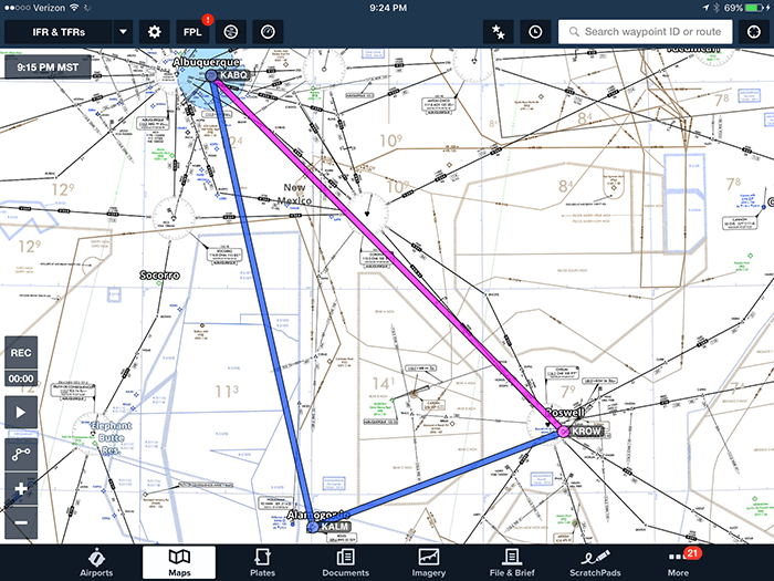
As you can see from this above image I have some tweaking to do on this flight plan.
Adjusting the Route
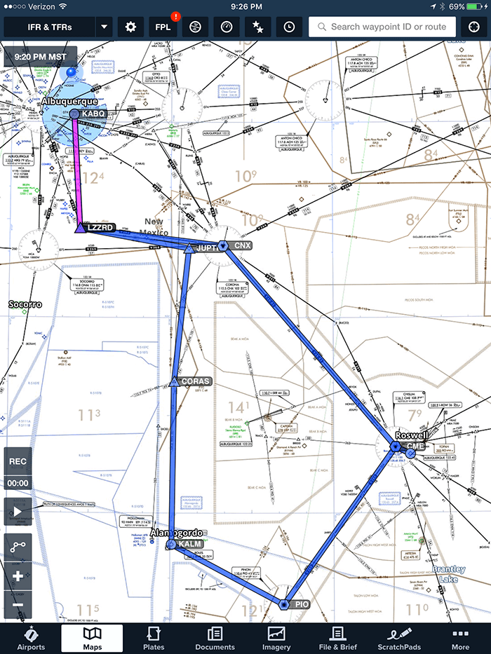
This first thing I noticed is the intended route of flight took me through restricted terrain and was close to, but not exactly on published IFR routes. So, naturally, I adjusted the path to follow the published routes as best as possible.
Keeping to this line of thinking allows for a few securities
- The published routes have been approved for obstacle clearance within 4 NM of the centerline of the airway.
- The Minimum Enroute Altitude (MEA) of these routes is easily accomplished by the 172.
- It’s mountainous terrain. If I’m under the foggles, or it’s real IFR I want to be where I know there are no surprise terrain hazards.
So, follow the published airways when practicable and plan to go around the restricted areas. This is a good plan to get the following path which is what I will use for the remainder of my planning.
Calling Flight Service
Now that I have the initial plan, the next is to call flight service to get the outlook so I can have an idea on what the weather along the route is going to be. Now, I know you’re thinking that it’s an IFR plan so it shouldn’t matter. Well, I’m here to tell you that I take the ‘all available flight information’ to heart. An extra phone call to get the weather and have it on record is well worth my time.
Yes, it’s part of figuring out my personal minimums. Yes, part of it is understanding what the weather is doing and what I’m comfortable flying in. Also, part of it is habit.
Remember, I’m currently a VFR pilot and that’s what we do. Even when planning, we get the outlook briefing and adjust our numbers accordingly.
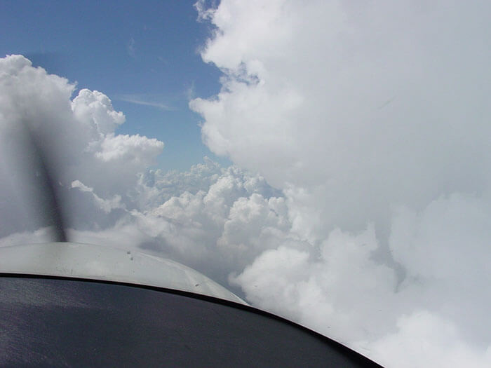
For this flight, outlook is ‘amazing VFR weather’. Should be a great flight.
Filling out the Flight Plan
Experienced users of foreflight will know that you can file the flight plan directly from foreflight. However, for this exercise and because I am still very new to the IFR stuff I will first fill out a paper flight plan. This is mainly for two reasons. First, it gets me in the habit of really understanding my flight plan. Secondly, I go through the motions of determining how long each leg will take and how much gas I need to complete each segment.
After only minor deliberation with my instructor we decided to separate the trip into two. The first leg to Roswell, the second to Alamagordo and then Back to Albuquerque. This was done manly because we didn’t want to write down all the changes they may have had for us along the entire route. Also, we were planning a stop in Roswell for lunch so it made sense to have two separate flight plans.
My instructor was questioning my paper method and asked if I planned on doing it that way for every flight. I told him my initial process is to do things by hand, and then use technology once I really understand the manual way of doing things. While he laughed he understood my reasoning.
Side note: my husband calls me the most technically inept technical person he’s ever met. My first instinct to do things the non-technical way is a good testament to that. However, I’m truly of the mind that if you don’t understand something in a non-technical way, then technology will only make you understanding of it worse. It may hide some of your inability to fully understand it but that may eventually catch up to you.
Ready for the Flight
Now that the plan is done, mapped out on paper and approved by my instructor the only thing left is to fly the plan. I really took to heart the phrase ‘plan the flight, fly the plan’. It can only make my flying more successful.
Once we have our route listed in foreflight, we file the flight plan through foreflight, self brief and head out to the plane. Check out the next article to see how the flight went.


