I was listening to one of my may podcasts on my way into work one day and they suggested using Air Sports Net’s weather, USAirNet, as a tool for weather forecasts. Since I’m always interested in learning new ways to improve my flying I figured I would check it out.
I’m glad I did. The weather section of the page is a great addition to my pre-flight planning.
Specifically I really like the three day forecast they do. They get the raw data direct from the National Weather Service’s GFS MOS Guidance and display it in an easy to understand format that shows all the things I want to know about in 3 hour blocks over a 64 hour period.
From wind direction, to chance of thunderstorms this site has one of the best graphical representations of the next 64 hours that I’ve seen to date.
Also, data, data, data. This site is packed with information about current conditions. Now, there is a point where you can have data-analysis paralysis but I believe this site does a phenomenal job of displaying it in such a way that a novice weather wannabe like me can understand.
A note to new users of USAirNet weather: the page is VERY busy with advertisements. They sort of trick you with a nice simple “launch page” where you input your desired location data but then things get crowded. It takes a minute to adjust your brain to figure out what is useful data and what is an ad.
That being said, once you figure out the layout you can get some really useful data in a one stop shop style.
Graphical Weather Forecast
About midway through the page is the meat and potatoes of what the weather page is all about.
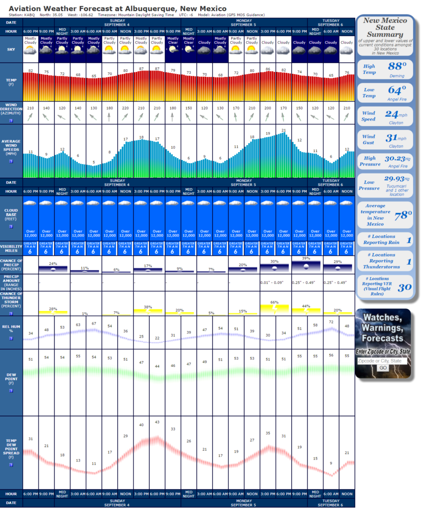
In one image I can see the projected trend of the weather as well as projected hazards and wind strength. Scrolling down to the bottom of the image I have a graphical representation of the expected precip amount, chance of thunderstorms in the area and the temp/dewpoint spread.
Check out this youtube video from a few years ago to see how MyGeekShow uses UsAirNet.com. He uses it for radio fliers / drones but it’s a good description on using the site.
Top to Bottom on the Chart
- Date
- Hour
- Overall Sky Conditions
- Temperature in Fahrenheit
- Wind Direction in Azimuth – The wind arrows are pointing in the direction of the wind assuming that North, or 0*, is at the top center of your screen.
- Average Wind Speed in MPH – Gusts are not depicted only the projected ‘constant speed’ of the wind.
- Cloud Base in Feet – All distances give are AGL. A depiction of ‘Over 12,000’ can be a forecast for clear skies.
- Visibility Miles – Much like a METAR, ‘Greater than 6’ is the highest it will show.
- Chance of Precip as %
- Precip Amount as a Range in Inches
- Chance of Thunderstorms as % – While self explanatory I like the way they show it. I’d rather not fly if the chance of a thunderstorm is 50% or greater. But then again, I have that luxury.
- Relative Humidity as % – The amount of moisture in the air! The leading cause of hazards in the air than any other weather phenomenon. This is an extremely important number to understand, especially as the temperature starts dropping.
- Dew Point in Fahrenheit
- Temperature Dew Point Spread in Fahrenheit – A good way to predict fog and other moisture saturation events.
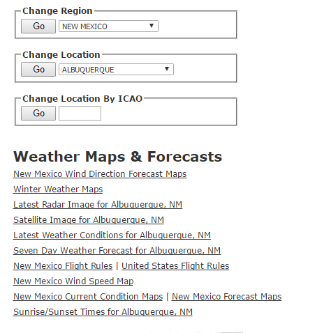
Other weather features
At the top of the page is a menu that will take you to other useful depictions of current weather with the exception of the seven day forecast link.
The radar and satellite images will take you directly to the image you need for the current airport you have selected. You don’t need to open a radar or satellite map and move around to find what you are looking for.
Radar
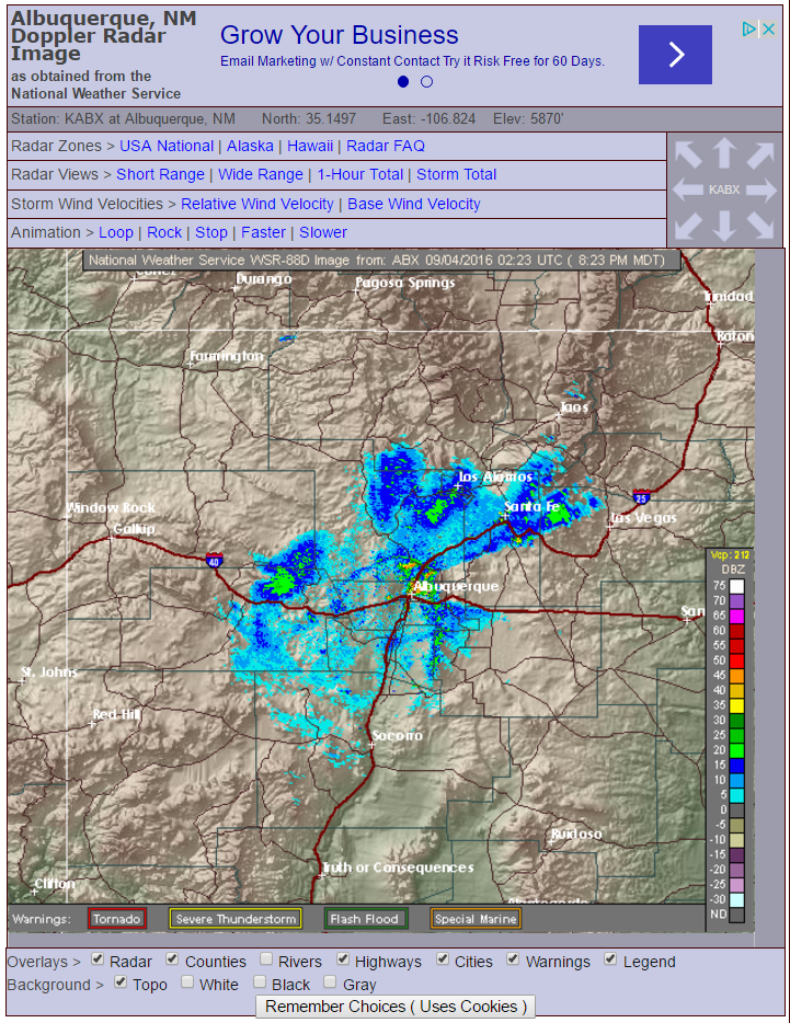
You can customize the look of the radar and the system will remember your customization with cookies if you chose.
The different options at the top of the radar image are really cool to play with as well. Changing the view to the long range gives you more area data. The relative and base wind charts are something I haven’t seen anywhere else, but they help paint the picture of what’s current.
Satellite
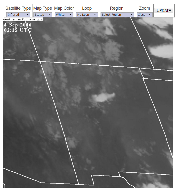
You can see three main types of Satellite image: Visible, Infrared and Water Vapor. If you’re planning a night flight the Infrared and Water Vapor will be your friend.
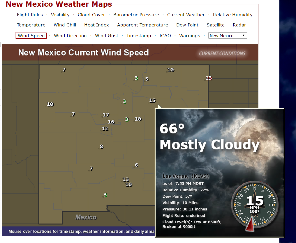
Wind Speed and Other Weather Maps
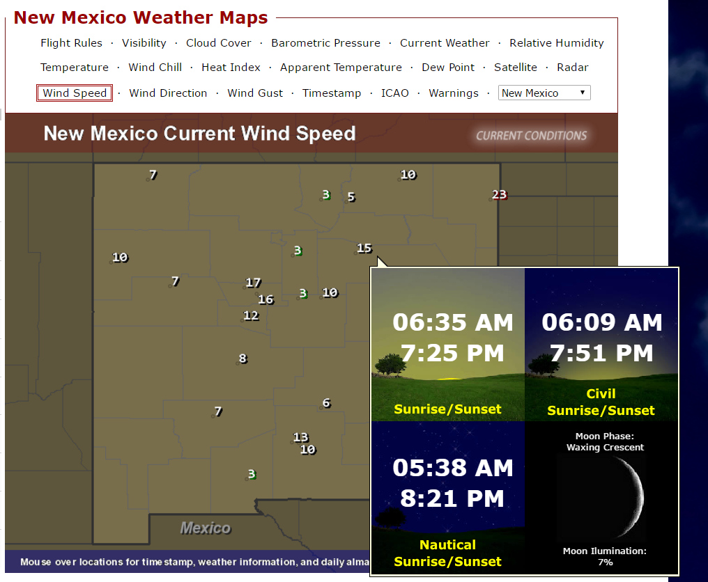
This one link has several different variations of current weather data for across a whole state. You can click on any of the additional links at the top of this map and see things like the current barometric pressure across the state, wind direction, dewpoint etc. Another really cool thing about this map is you can hover over a data point and it will call out all the information available about that data point. This call out also rotates to show additional information every 8 – 10 seconds.
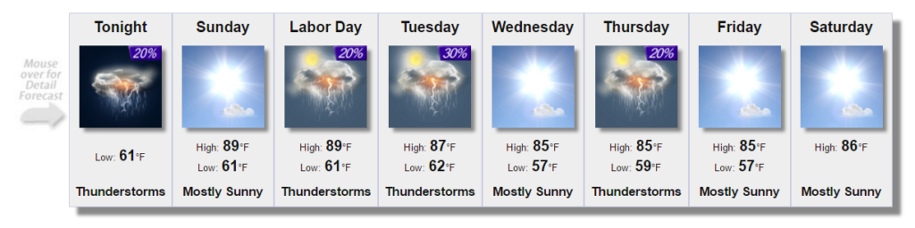
7 Day Forecast
Add in the 7 day forecast and you have a nice collection of data about current and forecast weather. This view also has mouse over call outs to give a little more detail on the day in question.
A few notes of constructive criticism
The navigation to get from one section to another and back again is horrible. You can tell these guys spent a bunch of time getting great data and displaying it in a different way but they should put a little focus and effort into making the site more user friendly.
The general layout is an affront to the eyes. Information is scattered around the page, mixed in with ads and other money making bits and peices. Now, I won’t judge anyone for trying to monetize their site, but come on guys… If you spend a little extra time on the layout of your information you site may rocket to the top for useful weather information.
Conclusion
The more I play around with this site, the more information I find. USAirNet did a great job of starting me down the path of “How much more can I know about the area”. I may even become a weather junkie using this site. It is my go-to site when I’ve already picked the date I’m going to fly and I watch the weather as my date gets closer.
I do not consider this site the only site to use to get your information. Rather, an additional resource to give yourself the best picture possible of the air around you and your plane. Finding USAirNet has given me more confidence in my preflight planning and displays the data in an easy to use format.
Have you ever used USAirNet before? Have comments, questions or sarcastic remarks? I’d love to hear from you in the comment section.


